
The trails in Big Canoe’s Wildcat neighborhood span more than seven miles, winding through sun-drenched, wildflower-filled meadows and fern-filled, shady creek valleys. The trails explore Wildcat’s popular play areas, dog parks and many quiet, serene spots, too. Hit the Wildcat trails for a great, energizing workout, or a nature-spotting stroll at dawn. And remember to watch for wildlife: birds, butterflies and bees buzz through the native flowers, and deer often forage on the plentiful greenery.
Wildcat Park’s paved running, walking and biking trails roll gently through the forest, visiting an old moonshine still, a small sculpture garden, sun-drenched meadows and several shaded, trickling creeks. The paved trails circle the Wildcat Recreation Area’s popular waterpark and ballfields, and connect Wildcat Park to nearby McDaniel Meadows. And three miles of paved and gravel trails at McDaniel Meadows Park wind through open, grassy meadows of wildflowers, and visit the ruins of a historic cabin.
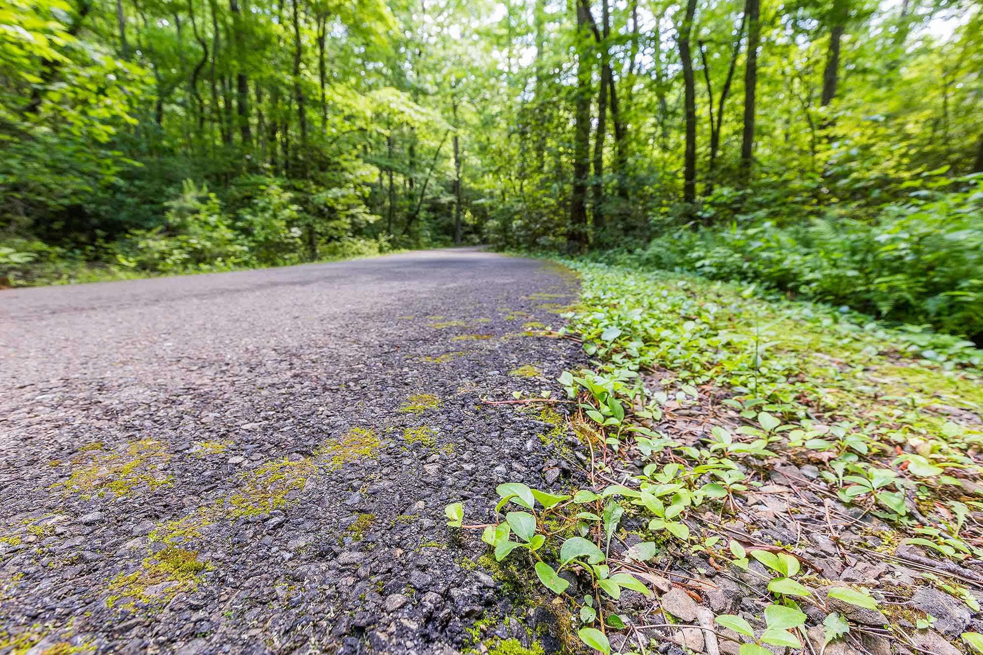
Run, walk or bike Wildcat’s Red Loop as it winds through shady forest, crosses wide wood bridges over trickling creeks, dives through dense carpets of fern and opens into sunny, grassy meadows. You’ll visit a historic moonshine still on the southeast section of the loop, and a small sculpture garden on the northern end. The Red Loop also visits two fenced dog parks, located near the main parking area off Wildcat Parkway, so remember to bring your four-legged adventure buddy for some off-leash fun. Up for more mileage? Combine Wildcat’s Red Loop and Blue Loop for a fantastic, rolling, 3-mile figure eight loop.
Maps & parking info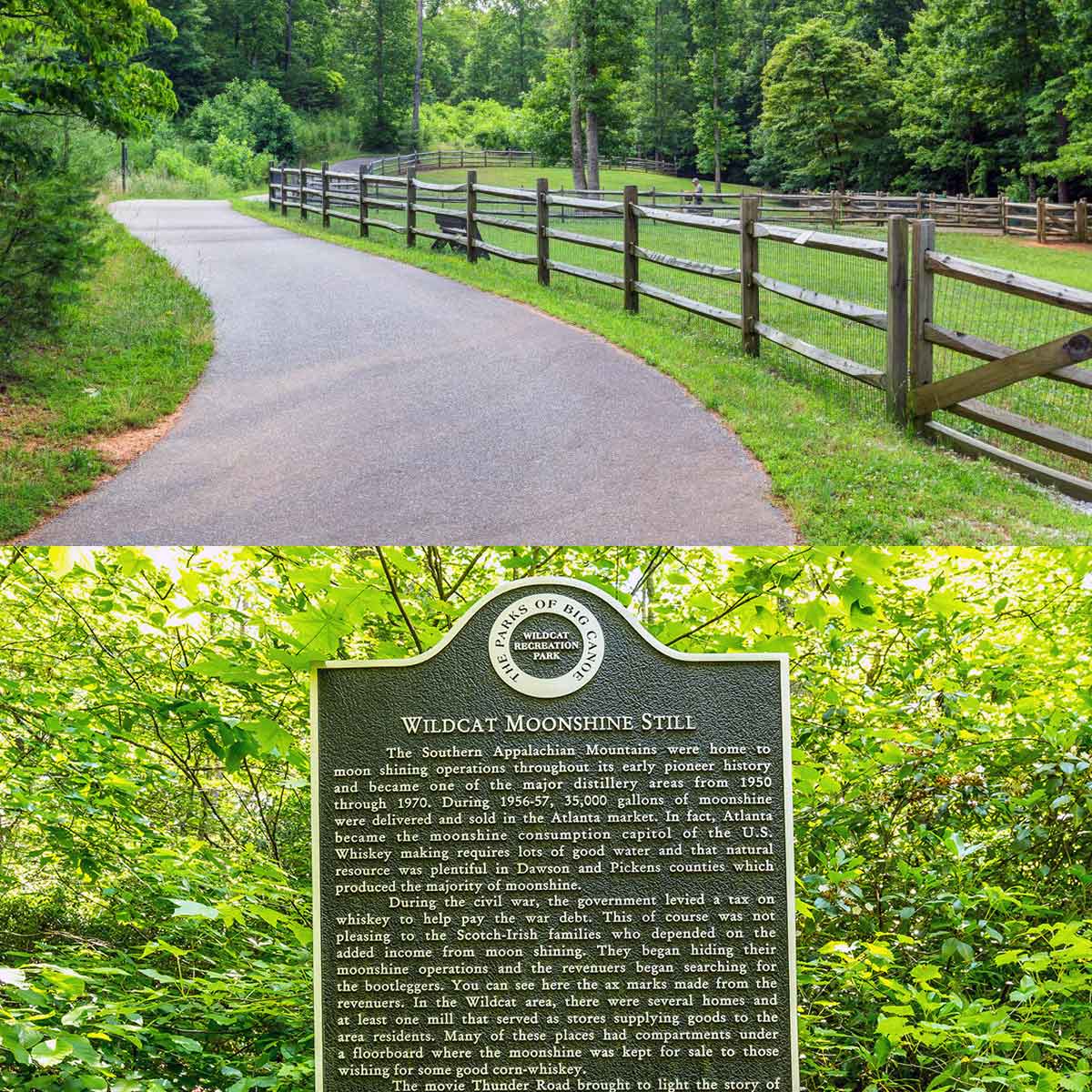
Explore the northern stretches of Wildcat Park on the rolling, paved Blue Loop. Hike, bike or run the trail through sun-dappled forest and open, sunny meadows, crossing a small creek via wooden bridges and visit a Native American trail tree along the way. This wide, smooth path is perfect for strollers – but don’t forget the sunscreen! The easiest way to access the Blue Loop is from the main Wildcat Park parking area off Wildcat Parkway, after a quick jog northbound on the Red Loop. (Several small trails access the Blue Loop as well, from access paths on Bobcat Ridge and Blazingstar Trail.)
Maps & parking info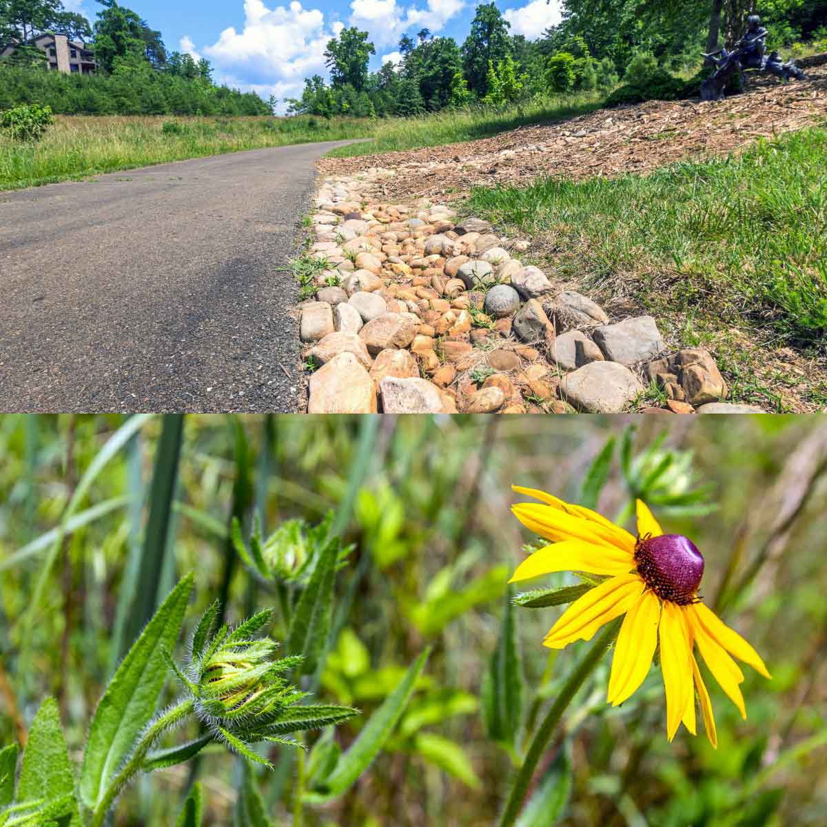
Add some distance to your Wildcat trail adventure on the Wildcat Conenctor! This paved trail spans between the Perimeter Trail and Red Loop, linking the Wildcat Recreation Area to the loops at Wildcat Park. Follow the Connector Trail through shady hardwood and pine forest, crossing a trickling creek via wooden bridges and exploring a forest carpeted in lush fern and vibrant green moss. For a fantastic (and scenic!) 4.2 mile run, park at the Wildcat Recreation Area, follow the Wildcat Connector to the Red Loop, and then loop the Red and Blue Loops in a figure eight before returning to the trailhead on the Wildcat Connector.
Maps & parking info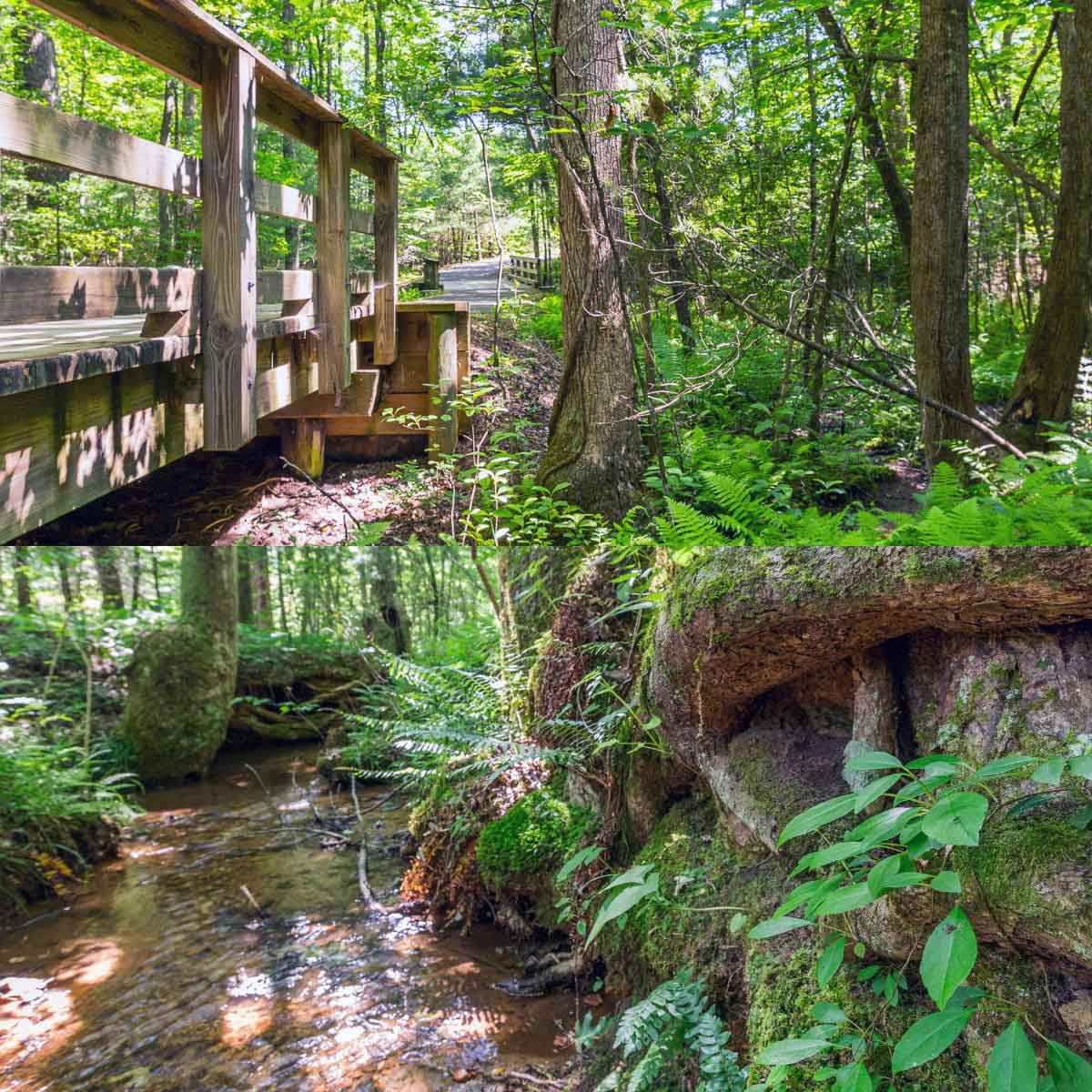
Follow the paved Perimeter Trail as it loops around the Wildcat Recreation Area; it’s a great loop for a quick stroll or jog, or great connection between Wildcat’s water park, picnic pavilion and ballfields. In warm-weather months, look for wildflowers and wild berries along the trail, and golden grasses that sway gently in the breeze. The Perimeter Trail also connects the McDaniel Meadows Park Access Trail and the Wildcat Connector, offering a ton of great options for a longer-length adventure.
Maps & parking info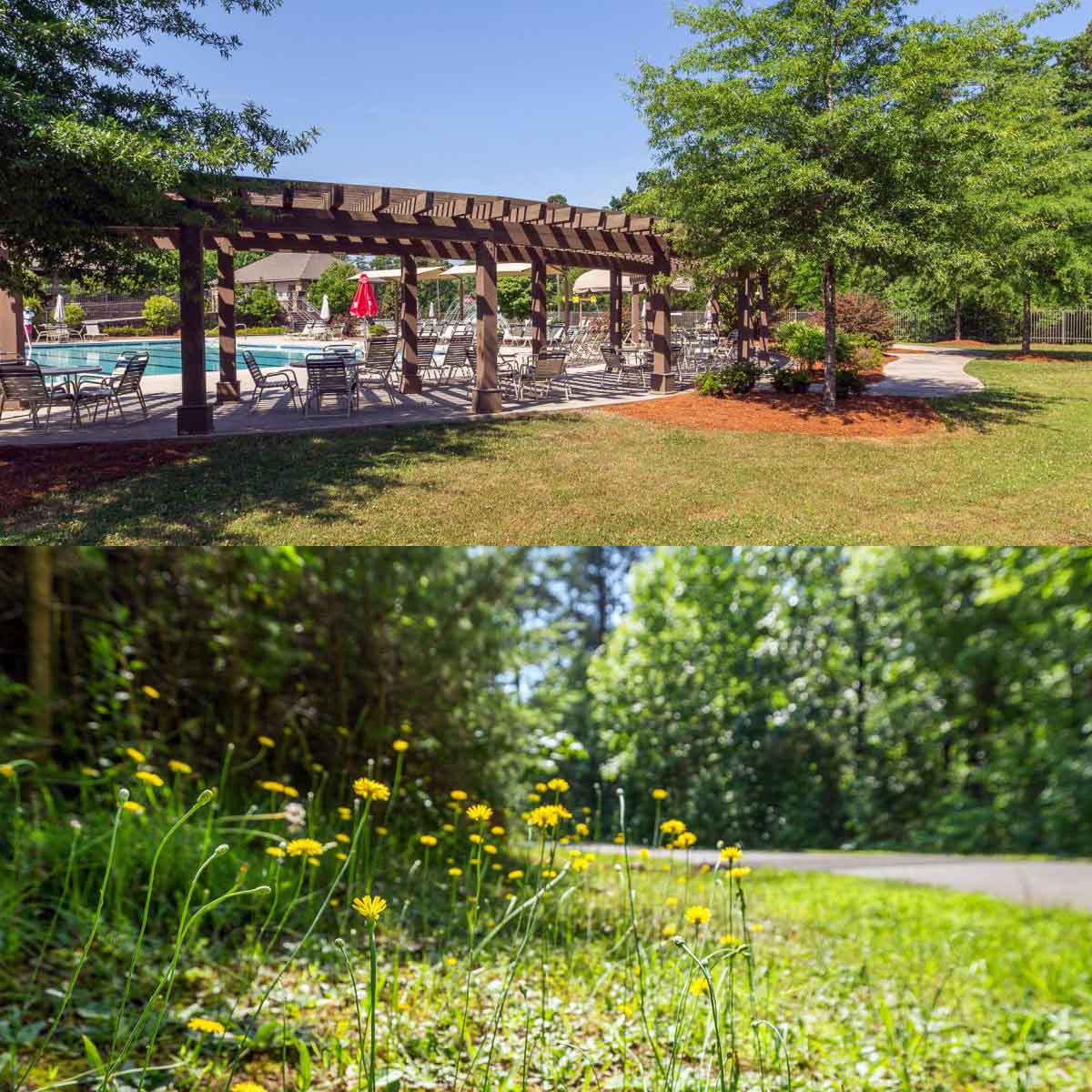
Explore the interwoven trails at McDaniel Meadows Park, and hike or run through grassy fields bursting with native wildflowers, shrubs and trees. Three miles of mixed-surface trails visit old cabin ruins, travel through pine and hardwood forest and visit a dog park for fun with furry friends. McDaniel Meadows Park is a great place to spot birds, butterflies and other meadow and woodland wildlife as they forage for food. Access the trails from the McDaniel Meadows parking area off Wildness Parkway, or the Perimeter Trail from the Wildcat Recreation Area.
Maps & parking info
The main parking area for the Wildcat Red Loop, Blue Loop and dog parks is located off Wildcat Parkway. The Wildcat Recreation Area is located on Wildcat Parkway, and offers plentiful parking and easy access to the Wildcat Connector Trail and Perimeter Trail. McDaniel Meadows Park is located off Wilderness Parkway near the North Gate, and offers ample parking. A small parking area with access to the McDaniel Meadows Trail is located off Yanegwa Path.