
Explore Big Canoe’s Nature Valley Park on more than seven miles of diverse, ultra-scenic hiking trails. The park’s trails range widely in difficulty, from the beginner-friendly Lake Trail on the shores of Lake Disharoon, to the difficult Nancy Womack Trail on the near-summit of Mt Oglethorpe, the original trailhead for the Appalachian Trail in Georgia.
Explore gorgeous, spilling waterfalls, shady creek valleys and sun-dappled forests filled with ferns and wildflowers. In addition to ample scenic beauty, the Nature Valley trails offer a lesson in Big Canoe’s history, visiting a historic log cabin, a creek powered water wheel, and even an old moonshine still.
For the ultimate adventure on four wheels, drive the Big Canoe Jeep Trail, a wide, rocky, offroad trail designed for 4×4 vehicles. The Jeep Trail visits many of Nature Valley’s historical and natural highlights while plunging through running creeks and climbing rocky inclines.
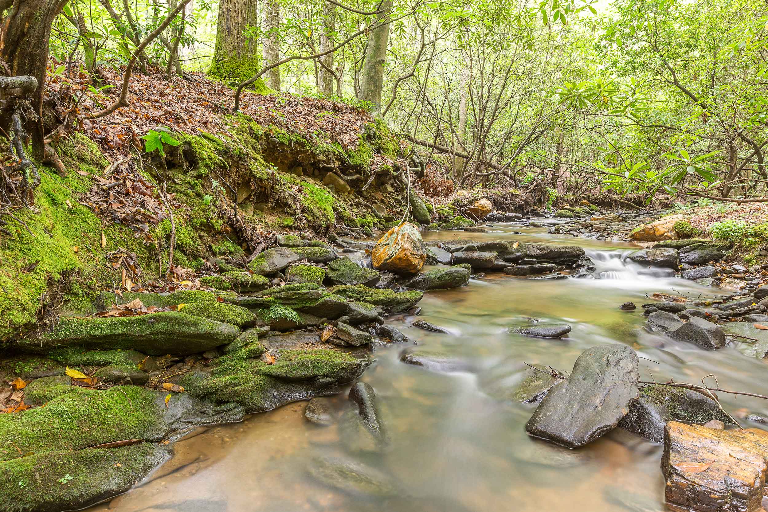
Explore the stunning cascades of a large, tumbling waterfall, a fern-filled creek valley, and mysterious rock mounds on the Lower Falls Trail, likely the most popular hike in Big Canoe. The trail’s southernmost trailhead is located at the Lake Trail’s end at the bridge over Disharoon Creek. Traveling northbound, the Lower Falls Trail follows the creek upstream to the main Nature Valley parking area on Wilderness Parkway, catching view after scenic view of Disharoon Creek along the way.
After crossing Wilderness Parkway at .6 mile, the trail spans multiple creek crossings via wooden bridge and crosses through wide glens of dense fern. Just before crossing the Jeep Trail at 1.25 miles, the trail passes several small rock mounds, thought to be Native American in origin (and similar to the larger mounds in Indian Rocks Park). The trail reaches the beautiful, tumbling cascades of the Lower Disharoon Falls at 1.5 miles.
If you’re up for the additional distance, the hike to the Upper Falls is well worth the mileage. From the Lower Falls, follow the Upper Falls Trail northbound, hiking along Disharoon Creek an additional half mile to the multi-tiered Upper Disharoon Falls.
Maps & parking info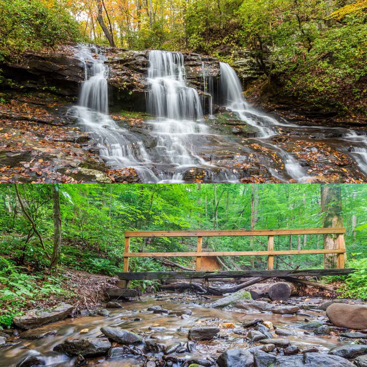
Hike the Upper Falls Trail in Nature Valley to explore two beautiful waterfalls on Disharoon Creek. The Upper Falls Trail spans a half mile, connecting the Lower Falls Trail to the Jeep Trail, near the Jeep Exit on Mountain Mint Drive. Starting at the Lower Falls waterfall, the Upper Falls Trail climbs through a mixed pine and hardwood forest along the banks of Disharoon Creek. En route to the Upper Falls, the trail visits several smaller waterfalls, where the creek spills and tumbles over the forest’s rocky terrain. At .5 mile, the trail crosses Disharoon Creek via a large wooden bridge, catching stunning views of the two-tiered Upper Falls waterfall as it carves through a large rock outcrop and spills into a clear pool below.
Maps & parking info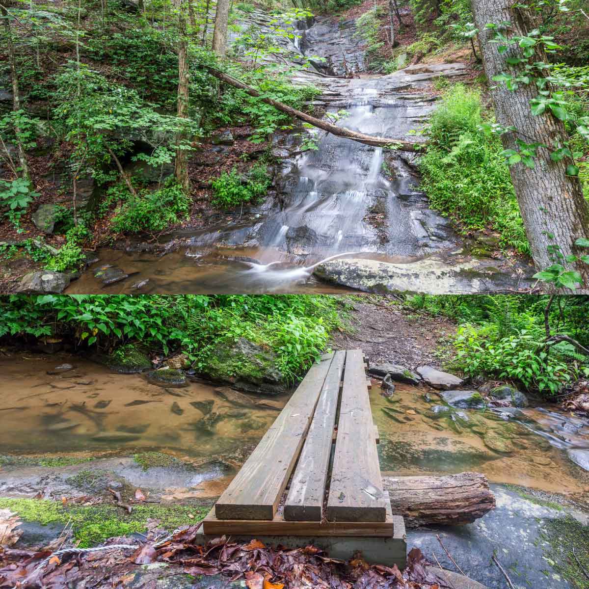
For a fun-filled 4×4 adventure, drive the Upper Jeep Trail through Nature Valley, exploring the valley’s highlights on a rocky, dirt road bed. The Upper Jeep Trail plunges through multiple stream crossings, ascends through a forest of mountain laurel, fern and wildflowers, and visits the Upper Falls and Lower Falls on Disharoon Creek. Interpretive signs point out trail features, including mysterious rock mounds, an old moonshine still, and a historic log cabin.
Pack a picnic, and enjoy a mid-drive snack at the picnic areas at Toad’s Glen (just before the Lower Falls) or the Upper Falls (just before the Jeep Trail exit). Vehicular traffic is one-way; access the Jeep Trail entrance on Wilderness Parkway. Prefer to explore this stretch of forest on foot instead? The Lower Falls and Upper Falls Trails follow roughly the same course, and hit the same trail highlights, on a slightly more difficult (but more scenic) trail.
Maps & parking info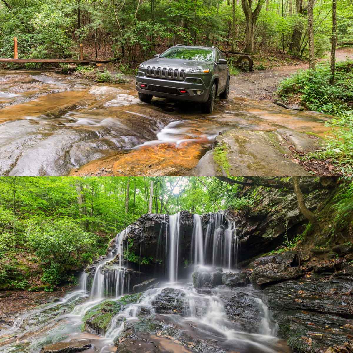
Hike the short but scenic Cabin Loop Trail through a mossy forest, following the tumbling Disharoon Creek to a historic log cabin. From the parking area on Yellow Root Drive, the trail descends through switchbacks before crossing the creek over a large plank bridge. The trail reaches the cabin at .2 mile, after passing a creek-powered water wheel. Follow the yellow-blazed cabin loop through a lush forest filled with mountain laurel, looping back to the cabin.
Tables beside the log cabin offer a perfect place for a mid-hike picnic. From here, retrace your outbound route on the Cabin Loop Trail to return to the trailhead, or hike the Jeep Trail a half mile to the spectacular Lower Falls waterfall.
Maps & parking info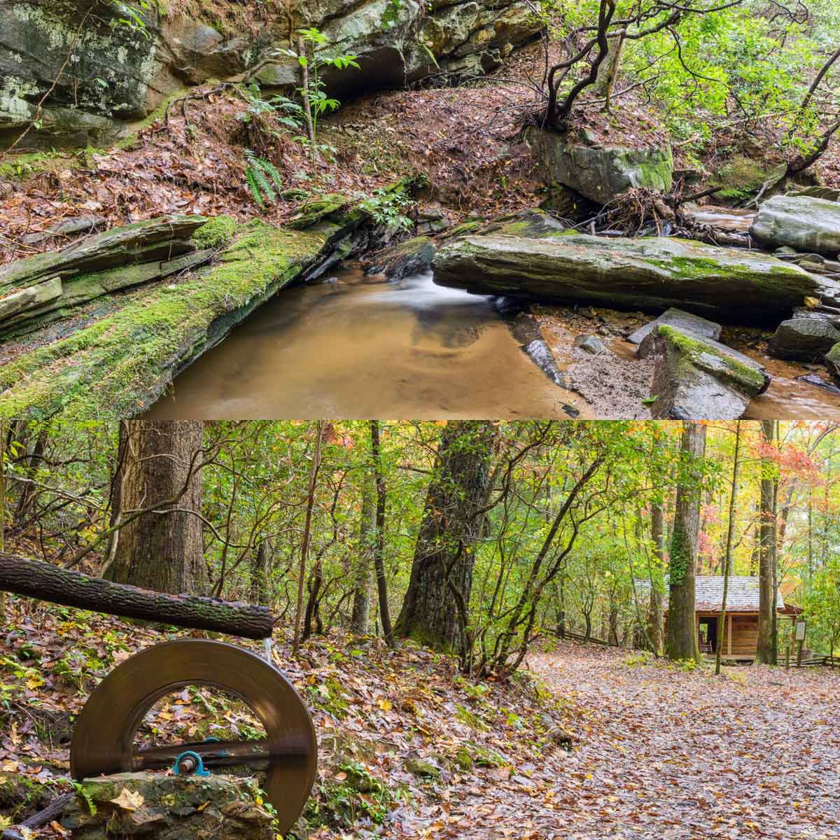
Hike the Nancy Womack Trail to explore a beautiful, rocky creek valley and multiple waterfalls on a workout-worthy trek. This difficult hike makes numerous stream crossings and climbs nearly 1200 feet to some of the highest elevations in Big Canoe near Mt Oglethorpe.
From the Jeep Trail exit near the Upper Falls, the Nancy Womack Trail dives into a fragrant hemlock forest after crossing Disharoon Creek via a wooden bridge. Following white trail blazes, the trail hikes northbound, passing a Native American trail tree at .2 miles just before crossing Valley View Drive. After crossing the road, the trail continues its climb, crossing Disharoon Creek multiple times via wooden bridges and stepping stones. The hike reaches Nancy Womack Falls at .65 mile, where Disharoon Creek tumbles and slides over an enormous, smooth rock outcrop.
Departing Nancy Womack Falls, the trail begins its most strenuous section. At .85 miles, follow a side trail to Ponder Point, the site of a secluded waterfall. Then continue the climb to the trail’s end, following the Nancy Womack Trail as it carves through sharp switchbacks under the canopy of towering hardwoods and several old-growth tulip trees. The trail ends at Deer Run Ridge.
Hike the nearby Mt Oglethorpe summit to catch sweeping views of Big Canoe. Catch the best views (and stunning sunrises) over Big Canoe’s mountains and lakes from the eastern viewing deck. For trail info and directions, visit mtoglethorpe.org
Maps & parking info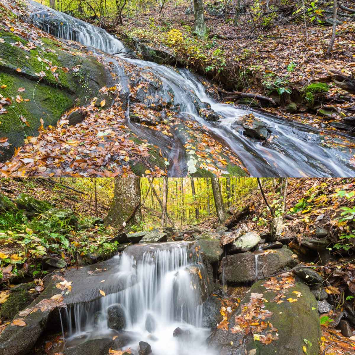
Explore the banks of Disharoon Lake on the easy and scenic Lake Trail. The trail departs the parking area at the Fitness Center and Swim Club, crossing an earthen dam and catching beautiful across-the-water views of the Big Canoe swimming beach and pool areas. The trail crosses a bridge over the Big Canoe rock slide, climbs to a picnic pavilion and then dips to cross the lake via a long wooden bridge. After crossing the bridge, the trail hugs the lake’s shoreline as it treks through a shady forest, exploring the creek delta where Disharoon Creek enters the lake.
The Lake Trail ends at a wooden bridge spanning Disharoon Creek, at a multi-trail intersection. From here, turn to retrace your steps to the trailhead, or keep exploring Nature Valley’s beauty on the Wildflower Trail or Lower Falls Trail.
Maps & parking info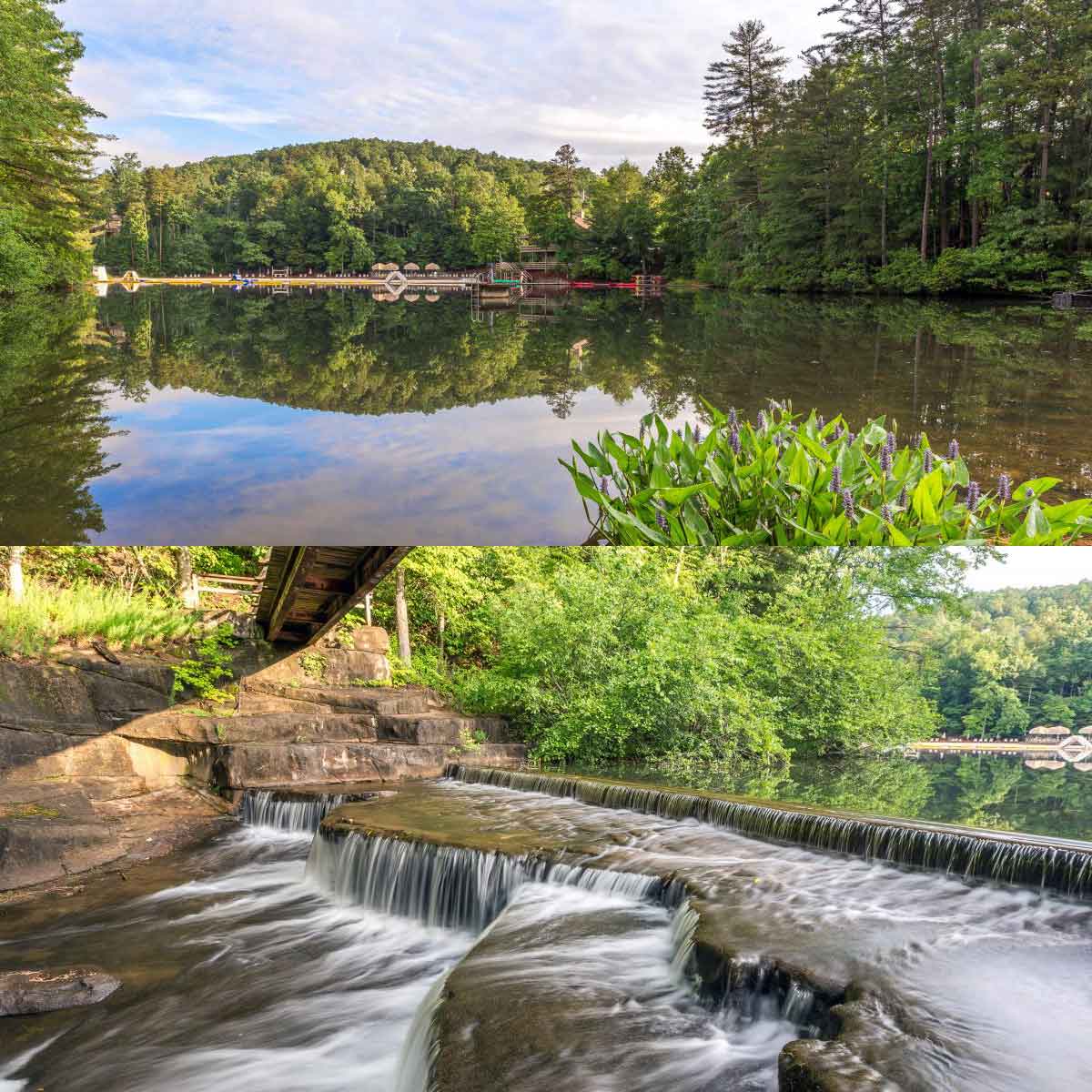
Hike through a lush creek valley on the Wildflower Trail, a green-blazed trail that connects the Lake Trail to the main Nature Valley parking area on Wilderness Parkway. Ferns and wildflowers thrive in the shady forest along the trail. The quiet forest is a prime place to spot deer, birds and other wildlife. In sections, the Wildflower Trail shares the same path with the Lower Falls Trail, following white and green blazes.
For a scenic, 1.3 mile hike from the Nature Valley parking area on Wilderness Parkway, follow the Wildflower Trail southbound to the Lake Trail’s end at the bridge over Disharoon Creek, and then loop back to the parking area on the Lower Falls Trail.
Maps & parking info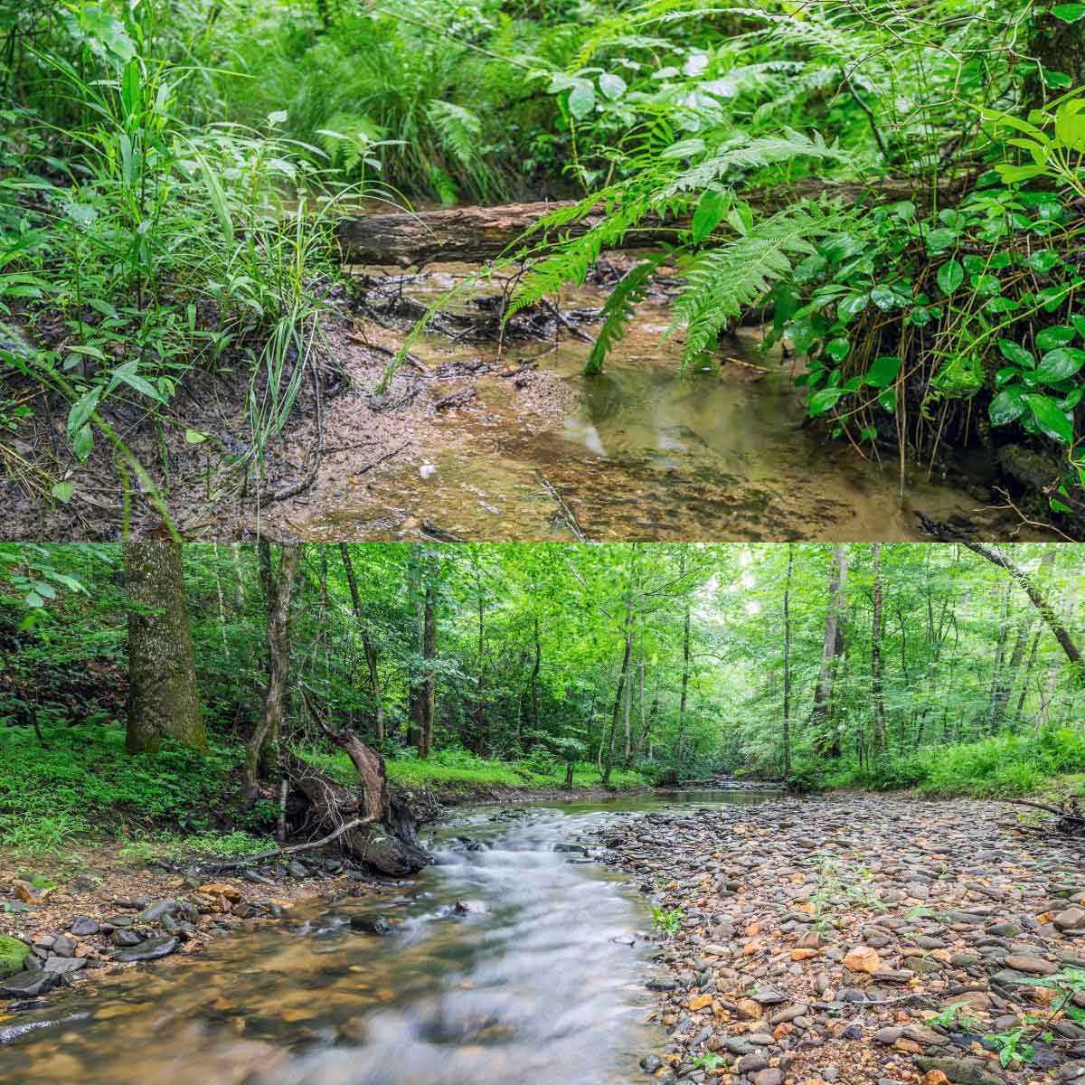
Hike or run the Lower Jeep Trail, following a gently rolling gravel road (now closed to vehicle traffic). The trail departs the main Nature Valley parking area off Wilderness Parkway, tunneling southbound through a giant metal culvert under the road. The Lower Jeep Trail descends to Lake Disharoon, passing an intersection with the Wildflower Trail (and access to the Lake Trail and Lower Falls Trail). While the Lower Jeep Trail isn’t the most scenic of Big Canoe’s trails, it’s perfect for a level trail run, and offers a connection to the Nature Valley trail system from the Big Canoe Swim Club.
Maps & parking info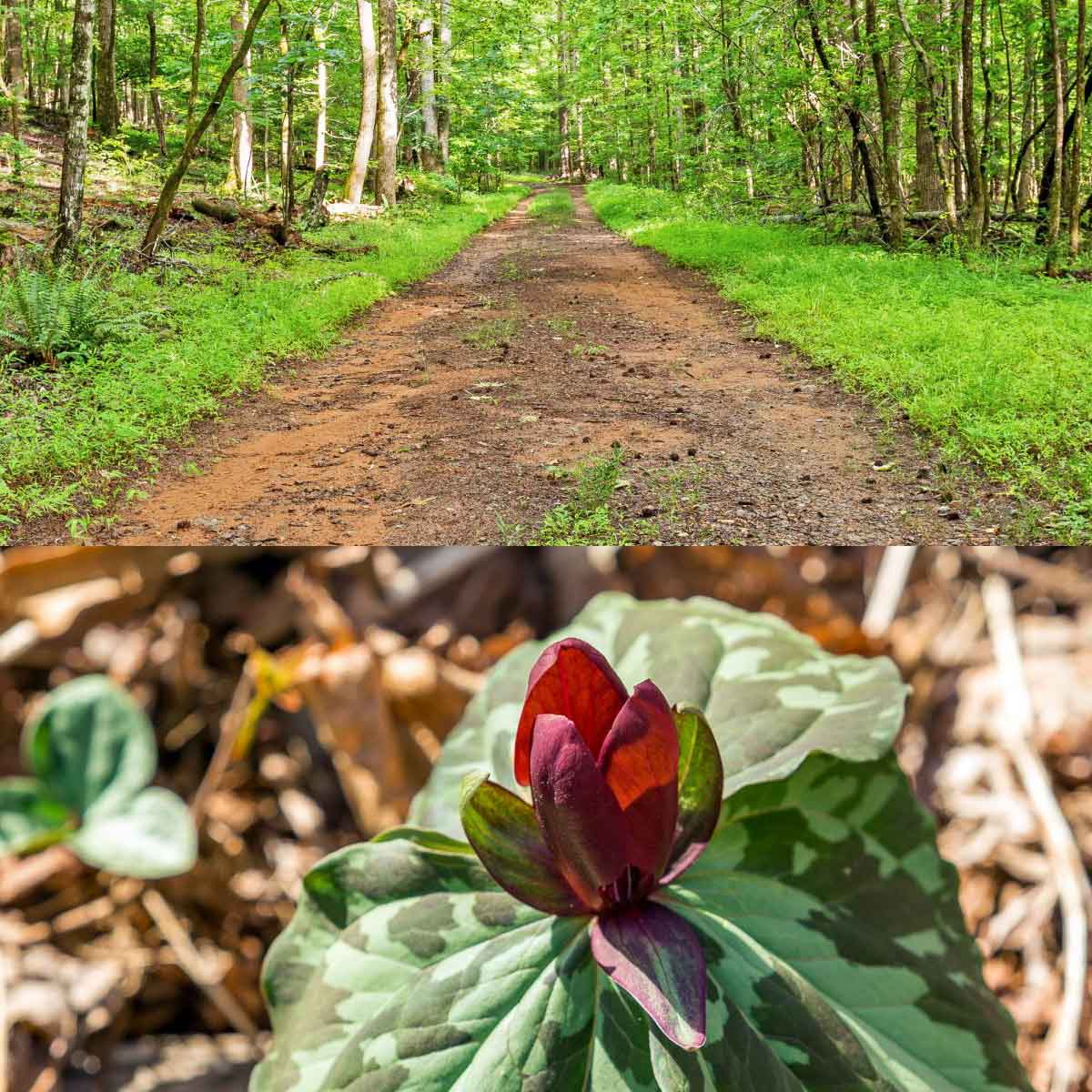
The main Nature Valley parking area is located on Wilderness Parkway, with access to the Lower Falls Trail, Wildflower Trail, Lower Jeep Trail, and the Jeep Trail entrance. Parking for the Lake Trail is available at the Fitness Center and Swim Club, located off Wolfscratch Drive. A small parking area for the Cabin Loop Trail is located off Yellow Root. Parking for the Nancy Womack Trail and Upper Falls Trail is located at the Jeep Trail exit on Mountain Mint Drive, a small parking area off Valley View Drive, and street parking (at a steep incline) on Deer Run Ridge on Sanderlin Mountain.